Software: GeoHammer for efficient QC on the field + Prism2 data processing software
Result
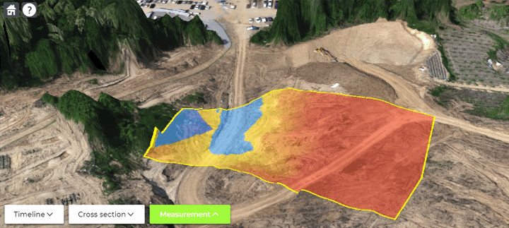
The area was difficult to access for terrestrial methods and traditional survey methods were not efficient. Drone-based technology allowed for 3x faster data collection. Flight automation and precise survey lines resulted for better data interpretation.
Earthworks
Exploit drone-based sensor data for pre-construction insights and post-completion validation
Tasks
Detect sub-surface inconsistencies or structures that may affect earthwork processes. Quick identification of potential issues, such as voids or water tables
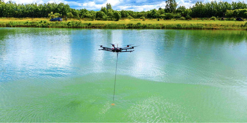
Use as a dredging work validation and QC tool to determine the water depth and correct amount of completed works are reported
Locate buried ferrous objects which may affect excavation or other earthwork activities. Can detect pipes, cables, or other buried infrastructure
Quality control after routine dredging operations. No other efficient solution to measure depth in between port piers. Drones can provide more accurate data than ships, as they are not affected by waves or currents. This can help to ensure that dredging operations have been carried out as agreed.
Use Case
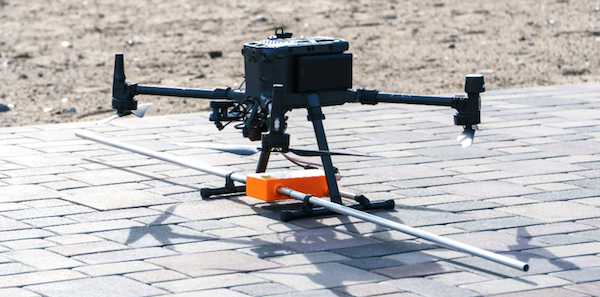
UXO clearance before earth works | Magnetometer
Customer
Undisclosed
Objectives
Identify unexploded ordinances to safely execute soil remediation operations
Drone-based magnetometer helped to identify and locate buried UXO, allowing for their safe removal and reducing the risk of digging accidents and project delays during the excavation phase.
Construction Monitoring
Use drone sensor data to monitor construction and avoid expensive rework
Tasks
Coordinate work parties, Resolve disputes, H&S compliance & Enhance communication
Monitor subsurface changes during construction
Identify problems early, reducing the risk of costly disruptions
Monitor the depth and characteristics of water in marine construction projects
Monitoring of underwater structures or geologic features
Monitor changes in the location or characteristics of buried ferrous objects during construction
Can help identify issues early, reducing the risk of disruptions due to unexpected buried objects
GPR solution allowed for non-destructive way for quality control. With drone-based GPR system it was possible to determine the as-built and validate it against design specifications eliminating the need for manned access at height. Complete elimination of test bore holes.GPR solution allowed for non-destructive way for quality control. With drone-based GPR system it was possible to determine the as-built and validate it against design specifications eliminating the need for manned access at height. Complete elimination of test bore holes.